Floods, Funds, and Forests
Typhoon Basyang and the Political Production of Disaster in Mindanao
In February 2026, Typhoon Basyang flooded communities across Northern Mindanao. In Iligan City and nearby lowland areas, rivers fed by the Bukidnon uplands overflowed after intense upstream rainfall. Evacuation centers reopened. Families fled before dawn. Schools suspended classes. Livelihoods stopped — again.
For many households, evacuation is no longer an emergency.
It is a recurring condition.
Basyang was not extraordinary.
Yet displacement returned.
This is the central reality: disaster in Mindanao is produced when degraded uplands, unequal land control, and poorly monitored public spending operate within the same political-economic system.
Rain falls.
But vulnerability is built.
Public Funds Rise — Flood Risk Remains
Department of Budget and Management (DBM) General Appropriations Act documents (2022–2025) show that approximately ₱545 billion was programmed for flood-control projects nationwide — among the largest allocations in recent years.
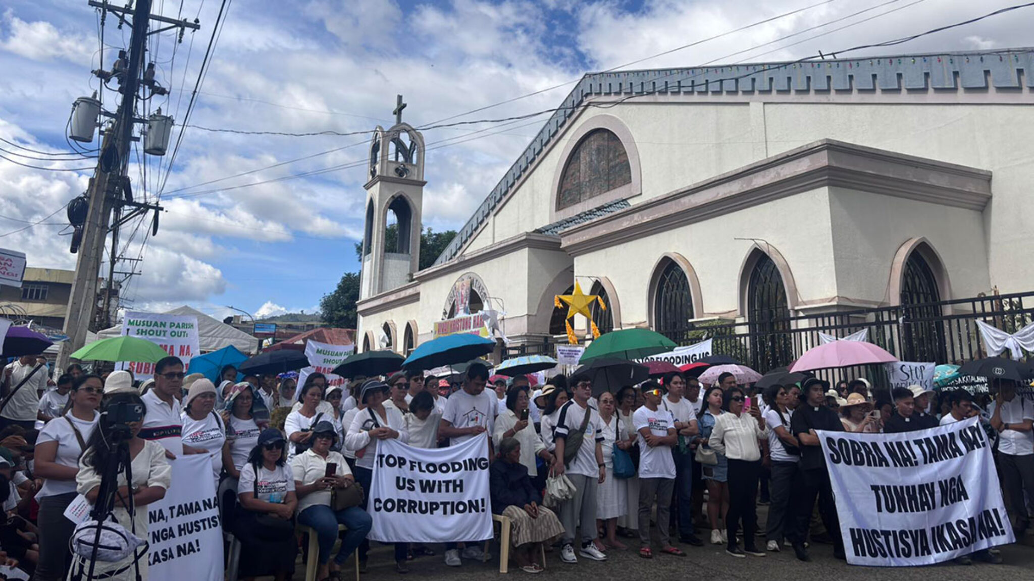
Photo: Romar Chuca. Source: Inquirer Mindanao (Mel N. Velez).
Investigative analysis by the Philippine Center for Investigative Journalism (PCIJ) estimates that between ₱42.3 billion and ₱118.5 billion annually may be lost to corruption risks, inefficiencies, or procurement irregularities. PCIJ data further show that 15 contractors secured about 20% of flood-control contracts during this period.
These patterns occurred during the current Marcos Jr administration.
Concentration does not automatically prove wrongdoing. But it reflects a political economy in which infrastructure spending is centralized among a narrow circle of firms. When contracting networks are structurally concentrated and oversight remains weak, public safety funds risk reinforcing patronage circuits instead of reducing ecological vulnerability.
Large allocations alone do not prevent floods.
When headwaters are degraded and budgets are poorly implemented, disaster risk becomes institutionalized.
Risk grows upstream.
Contracts grow downstream.
A Warning Before the Storm
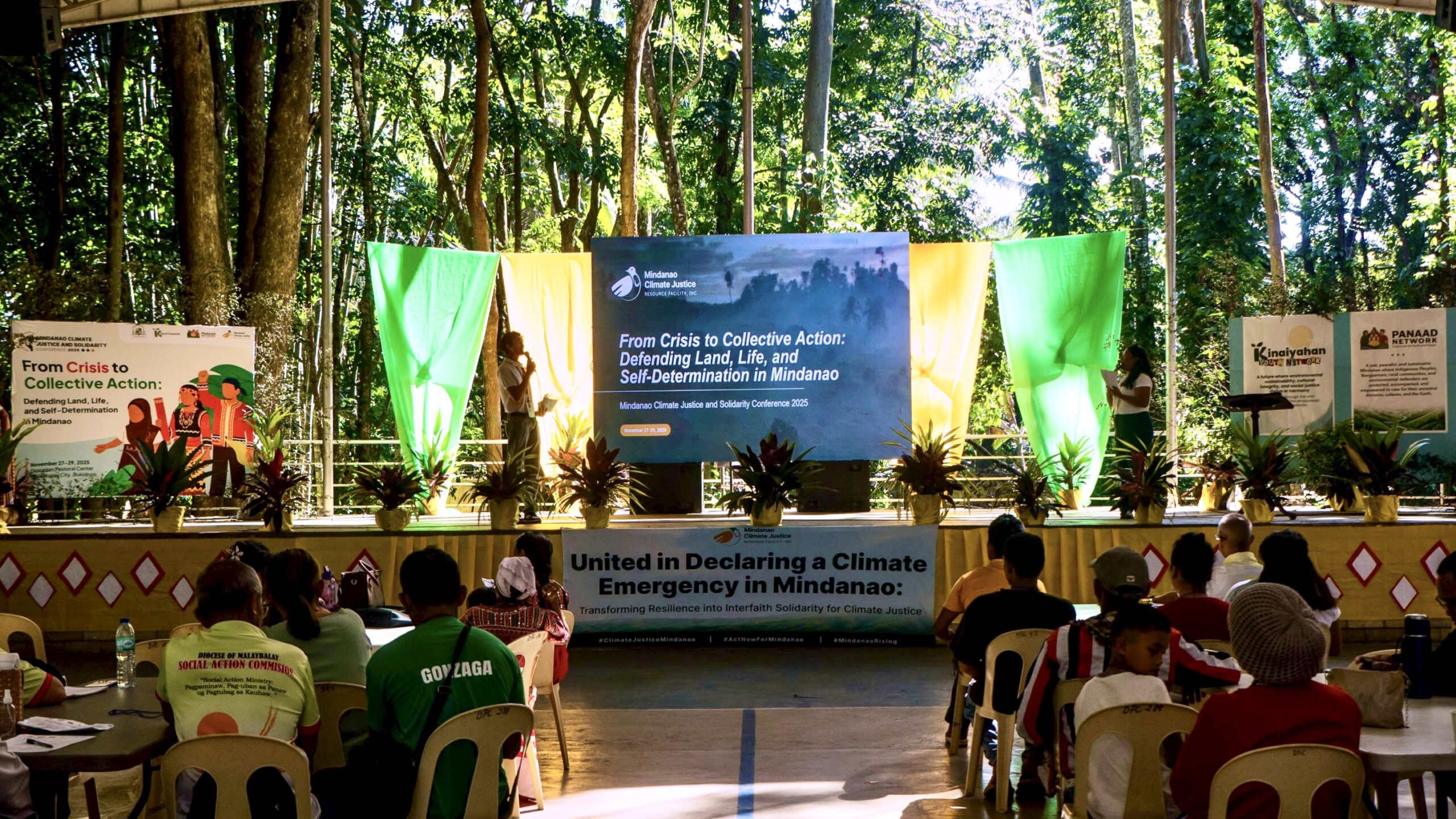
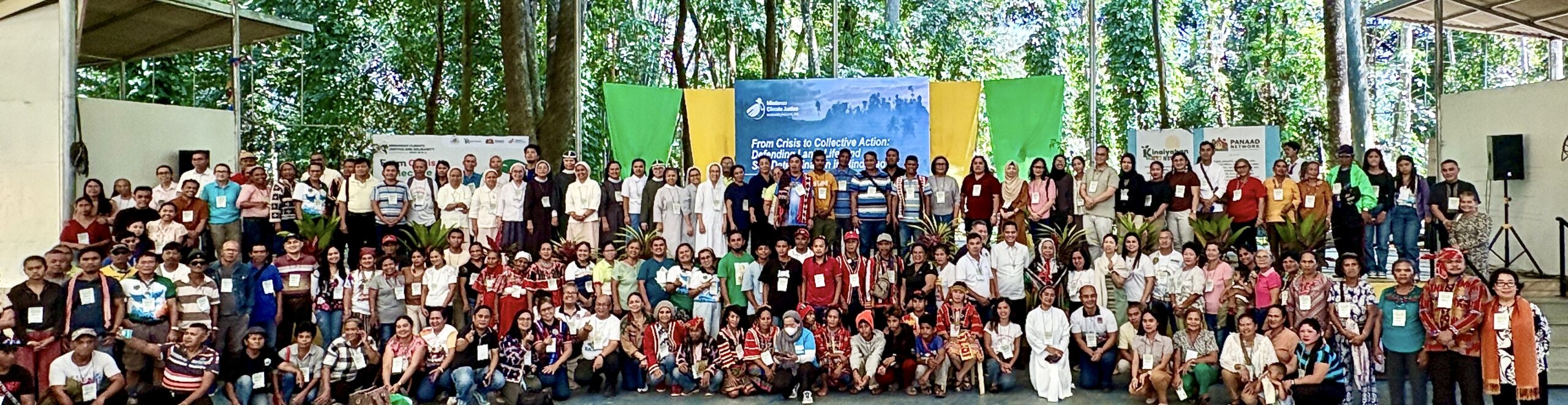
Months before Basyang struck, the Mindanao Climate Justice and Solidarity Conference 2025 gathered church leaders, scientists, Indigenous representatives, Moro advocates, and civil society networks in Malaybalay.
Their shared assessment was clear: poverty, land conversion, watershed destruction, extractive expansion, conflict, and governance failures are interlocking drivers of disaster in Mindanao.
Basyang did not contradict that assessment.
It confirmed it.
Flood risk is shaped upstream — in land policy, forest governance, development priorities, and public finance.
Mindanao: Vulnerability by Design
Mindanao is home to more than 27 million people and functions as a major agricultural and resource frontier. Yet it remains the poorest major island in the country.
According to 2025 Social Weather Stations (SWS) data, 69% of families in Mindanao self-identify as poor and 61% report food poverty. Philippine Statistics Authority (PSA) data show Bukidnon’s poverty incidence at approximately 27%.
This is not incidental. It reflects unresolved agrarian reform, unequal land tenure, and the concentration of productive land in large estates, plantation zones, and corporate-controlled territories.
The Philippines remains among the world’s most disaster-prone countries. PAGASA recorded 23 tropical cyclones entering the Philippine Area of Responsibility in 2025. PHIVOLCS recorded major seismic events, including a double earthquake (7.4 and 6.8 magnitude) in eastern Mindanao.
Hazards intensify.
But disaster emerges where ecological fragility meets structural inequality.
Mindanao’s exposure is produced.
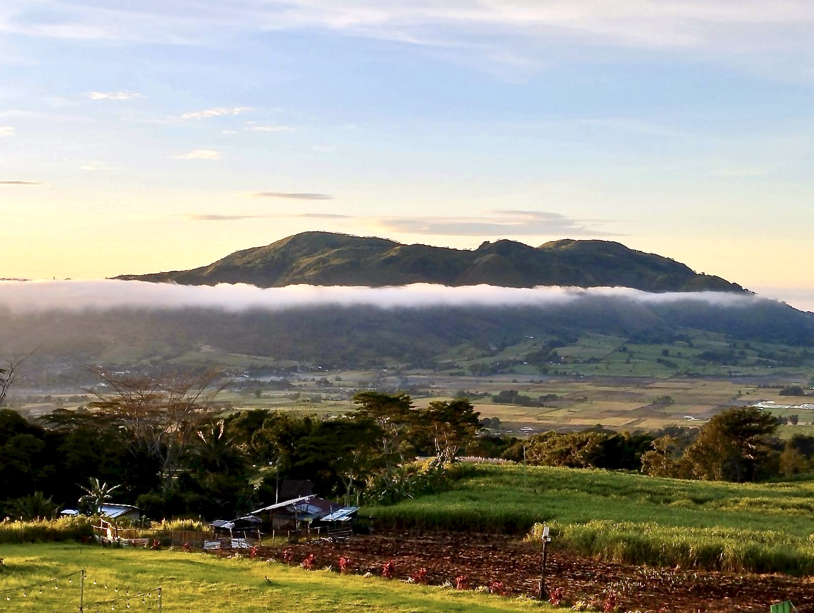
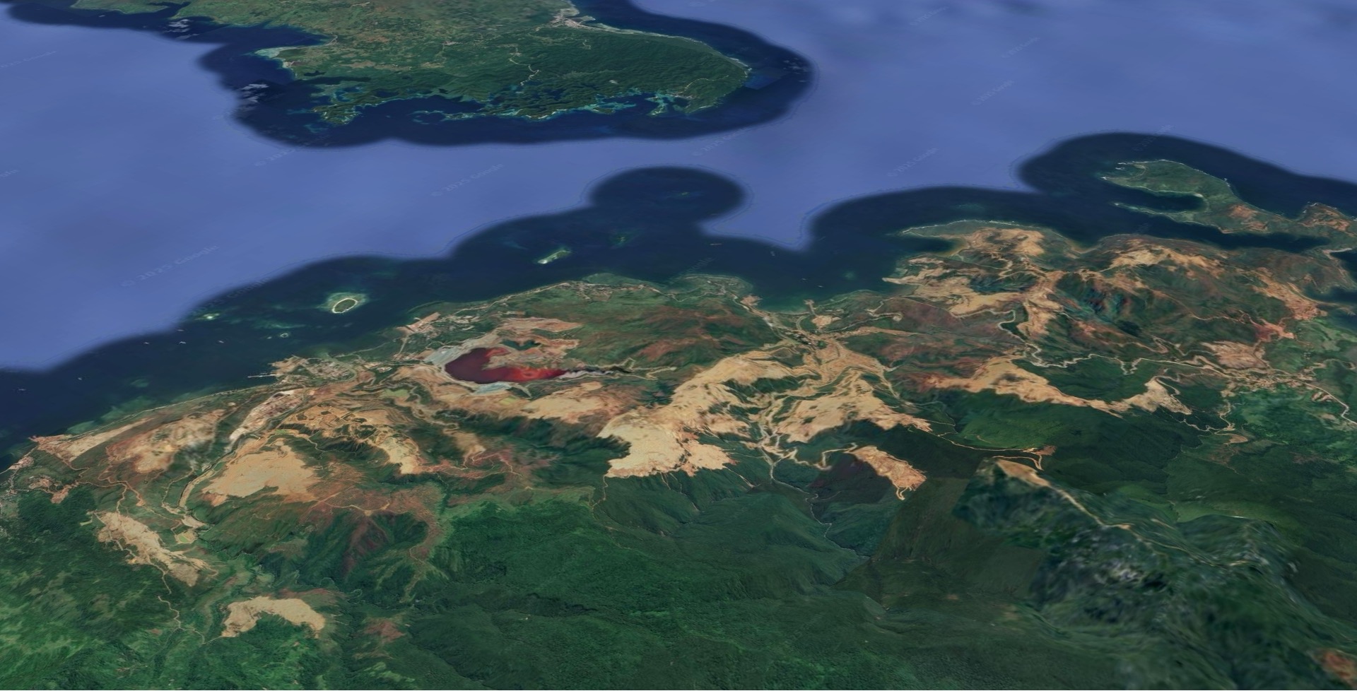
Where Floods Begin: The Bukidnon Headwaters
To understand Iligan’s floods, one must look upstream.

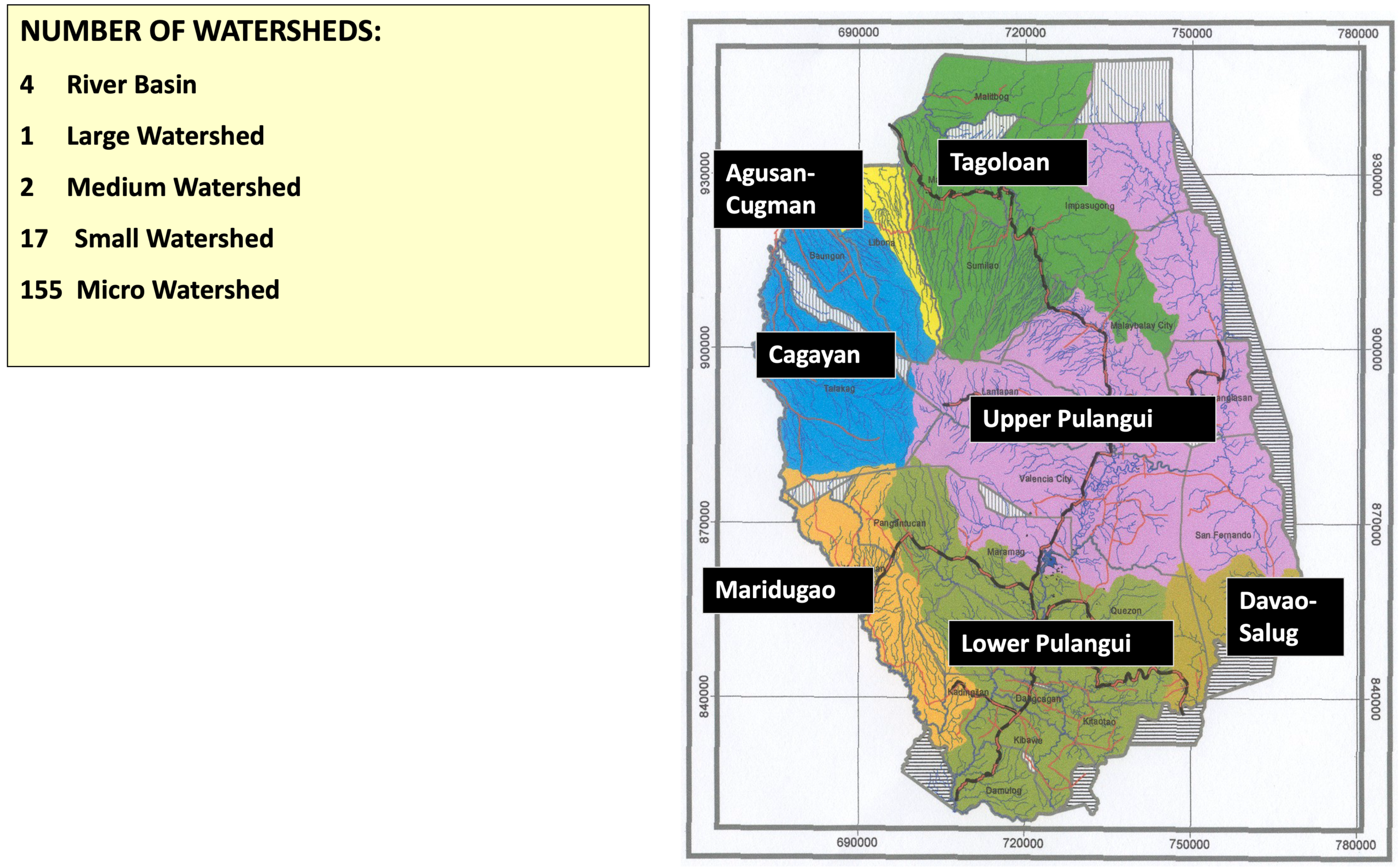
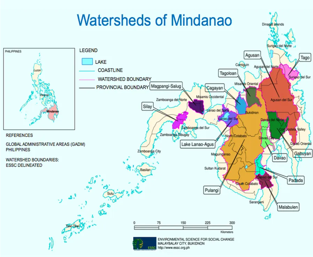
Bukidnon sits at the ecological core of Mindanao. MinDA and watershed references identify it as Mindanao’s headwater province, with six of the island’s eight major river systems originating in its uplands: Pulangi, Tagoloan, Cagayan, Maridugao, Davao-Salug, and Agusan-Cugman.
These watersheds cover roughly 94% of the province and are structured through 4 river basins, 1 large watershed, 2 medium watersheds, 17 small watersheds, and 155 micro-watersheds. Nearly one-third of Mindanao’s population depends on their stability.
Yet their condition is severely compromised. Environmental Science for Social Change (ESSC, 2019) and provincial assessments indicate that about 65% of Bukidnon’s uplands are denuded and only 23.5% of its 906,686 hectares remain natural forest. National forest cover stands at 24.07% of total land area.
This degradation is systemic. It is tied to decades of logging, plantation conversion, mining, and infrastructure expansion driven by an export-oriented, resource-extractive development model. Production feeds global commodity chains dominated by transnational corporations and foreign capital. In this arrangement, peripheral regions supply raw materials while absorbing ecological damage.
Forests absorb water.
Bare slopes accelerate runoff.
Silted rivers constrict flow.
When heavy rains fall, water moves fast.
The 2025 UNEP Emissions Gap Report and global climate monitoring datasets show emissions at 59.4 billion tons and global temperatures around 1.48°C above pre-industrial levels. Climate change intensifies rainfall extremes. But land policy determines their impact.
Poverty and Ecological Breakdown: One Crisis
At the 2025 conference, Fr. Reynaldo Raluto emphasized that ecological decline and poverty reinforce one another. Families emerging from hardship are pushed back into crisis when floods strike.
Repeated displacement is not only environmental damage.
It is economic destabilization.
Hazard is natural.
The scale of disaster is political.
Land Conversion and Extractive Expansion
PSA and ESSC data show that hundreds of thousands of hectares across Mindanao are devoted to large-scale plantation crops. Northern Mindanao alone accounts for more than 127,000 hectares.
In Bukidnon, land allocation includes:
- 114,912 hectares of corn
- 102,625 hectares of sugarcane
- 42,194 hectares of rice
- 24,890 hectares of pineapple
- 22,651 hectares of rubber
This infrastructure-led, export-oriented model privileges capital accumulation over ecological stability and community land security. Mindanao functions as both resource frontier and internal colony — supplying land, labor, and commodities to national elites and global markets while local communities bear displacement and environmental risk.
Monocrop expansion simplifies ecosystems and weakens watershed resilience.
At the same time:
- Small farmers lack secure tenure
• Indigenous communities face ancestral land displacement
• Moro families relocate to marginal zones
• Urban poor households settle along floodplains because safer land is inaccessible
Disaster exposure is inseparable from concentrated land ownership and unfinished land reform.
Those who control uplands accumulate revenue.
Those downstream absorb risk.
Climate Justice: Global Emissions, Local Consequences
The Philippines contributes minimally to global greenhouse gas emissions yet faces disproportionate impacts — a pattern consistent with global climate injustice. Historically industrialized economies accumulated wealth through fossil fuels; climate-vulnerable regions absorb the damage.
As disaster scientist Dr. Mahar Lagmay notes, disaster occurs where hazard intersects with exposure and weak resilience.
Global warming intensifies rainfall.
Unequal development determines who evacuates.
Red-Tagging, Security Framing, and Ecological Defense
At the conference, Bishop Raul Dael warned that forest defenders are often labeled “anti-development.”
In parts of Mindanao, environmental protection and ancestral land defense intersect with security operations and counterinsurgency frameworks. When civic actors are red-tagged or criminalized, scrutiny weakens and extractive projects advance.
When democratic space contracts, ecological risk expands.
Environmental protection depends on civic freedom.
After Basyang: The Accountability Test
Typhoon Basyang did not create a new crisis. It revealed a system already in operation:
- Degraded headwaters
• Concentrated land ownership
• Plantation expansion tied to global commodity flows
• Infrastructure spending structured through centralized contracting networks
• Persistent poverty
• Weak accountability mechanisms
Breaking this cycle requires structural transformation — not only better implementation, but a shift in development priorities that tie Mindanao’s land and watersheds to extractive, export-dependent systems shaped by national elites and global capital.
It requires:
- Independent audit and full disclosure of flood-control contracts
• Transparent, searchable public budget portals
• Legal accountability where irregularities are proven
• Large-scale watershed rehabilitation
• Protection of environmental defenders and Indigenous land rights
• Genuine land reform and secure tenure
• Community-based monitoring
• A moratorium on extractive expansion in critical watersheds
Floods do not begin in the sky.
They begin in land policy.
They begin in development priorities.
They begin in how public funds are allocated — and who benefits.
Without structural change, the next evacuation is not a question of if — but when.
For families in Iligan and across Northern Mindanao, the question is no longer whether another storm will come.
It is whether the system will change before it does.